Web GIS Developer · HeraldX

Mapping
Earth from
orbit.

I'm Muhammad Taimoor Ashfaq Malik. I build web mapping platforms, GeoAI pipelines and remote-sensing tools that turn satellite pixels into decisions.

Learn more
ALT
705.0 KM
VEL
7.504 KM/S
LAT
33.6844° N
LON
73.0479° E
MODE
BURN
LINK
NOMINAL

01 — Mission profile

Geospatial science, engineered for the web.

I build web mapping platforms and geospatial software, automate geoprocessing workflows, and apply AI/LLM tooling to spatial decision-making across disaster management, hydrology and urban planning. Currently a Web GIS Developer at HeraldX and an M.S. Remote Sensing & GIS candidate at NUST.

  1. SYS.01

    Web GIS & Spatial Data Infrastructure

    Interactive mapping apps with React, MapLibre, OpenLayers and Leaflet on PostGIS, GeoServer and TiTiler backends. Topology validation for Pakistan's National Spatial Data Infrastructure.

  2. SYS.02

    GeoAI & Machine Learning

    YOLOv5 object detection on SAR imagery, and local LLMs (Ollama, LangChain) embedded in Spatial Decision Support Systems for explainable spatial reasoning.

  3. SYS.03

    ArcGIS Pro SDK & Desktop Tools

    C# / .NET 8 Add-Ins with real-time Consistency Ratio validation, ArcPy automation and packaged standalone spatial utilities.

  4. SYS.04

    Remote Sensing & Hydrology

    30-year RUSLE soil erosion modelling, Landsat / Sentinel-2 spectral indices, Google Earth Engine batch processing and GLOF disaster risk assessment.

0Roles
0Projects
0Springer paper
0Certificates

02 — Orbit log

Where I've been operating.

Sep 2026 — Present

Web GIS Developer

HeraldX (Herald Analytics) · Islamabad

  • Developing interactive web GIS applications and geospatial dashboards for analytics products.
  • Building map front-ends with React and MapLibre / OpenLayers backed by PostGIS and GeoServer.
  • Designing spatial data pipelines and APIs that serve vector and raster layers to the web.
Oct 2025 — Sep 2026

Junior GIS Analyst

Nook Office Solutions · Islamabad

  • Translated urban planning codes into structured spatial datasets for large-scale zoning projects.
  • Engineered Python scripts automating data cleaning, batch processing and cloud uploads.
  • Iteratively refined internal QA tools, boosting output validation speed.

Jun 2025 — Sep 2025

GIS Intern

National Disaster Risk Management Fund (NDRMF) · Islamabad

  • Digitized and managed Pakistan's energy infrastructure datasets for national risk assessment.
  • Conducted flood extent mapping for Punjab flood events evaluating hazard severity.
  • Built Python satellite data acquisition pipelines integrated with PostgreSQL / PostGIS.

Jun 2024 — Aug 2024

Cadastral Mapping Intern

Gravity Solutions · Rawalpindi

  • Digitized land parcel boundaries and removed topology errors.
  • Developed Python automation scripts for parcel database management.

Jun 2023 — Jul 2024

Research Intern

Global Climate-Change Impact Studies Centre (GCISC) · Islamabad

  • Developed a RUSLE soil erosion tool modelling 3-decade sedimentation in Tarbela Reservoir.
  • Executed mangrove restoration site suitability using Multi-Criteria Decision Making.
  • Authored Python GIS toolboxes streamlining automated geoprocessing.

Ground training

2025 — Present

M.S. Remote Sensing & GIS

National University of Sciences & Technology (NUST)

Advanced spatial analytics, GeoAI, satellite radar imagery and spatial statistics.

2021 — 2025

BS Geoinformatics

PMAS Arid Agriculture University, Rawalpindi

Thesis: Web-based tool for spatio-temporal crop mapping using Sentinel imagery in Punjab.

03 — Observations

Selected projects.

Software add-ins, decision support systems, satellite analytics and geospatial toolboxes.

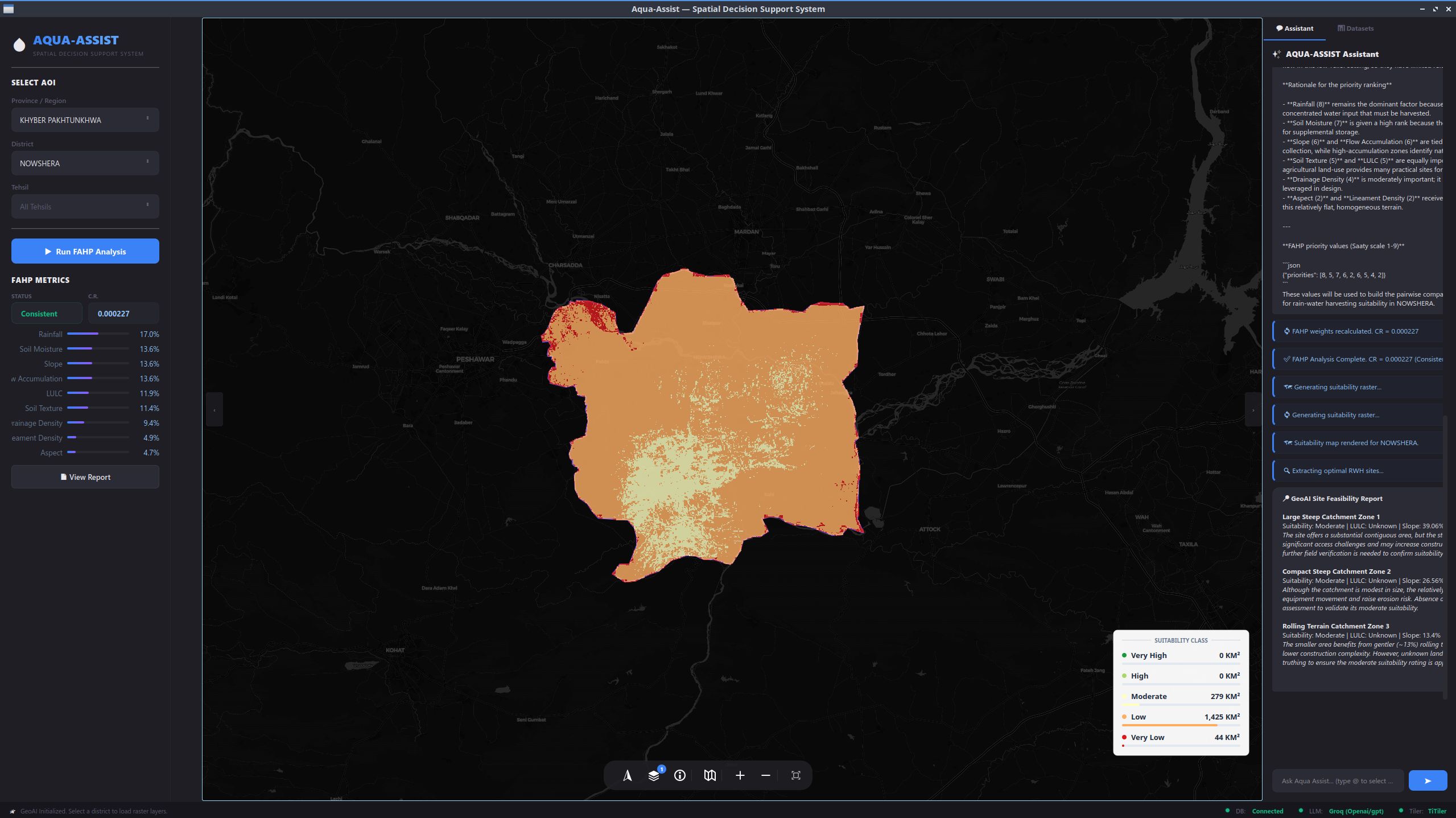
AquaAssist SDSS interface
GeoAI / SDSS

AquaAssist: GeoAI Spatial Decision Support System

Agentic SDSS for rainwater harvesting suitability. DEM and multispectral analysis, Fuzzy AHP, local Ollama LLM reasoning and a Streamlit / PyQt Folium map interface.

PythonLangChainOllamaFAHPGDALFastAPI
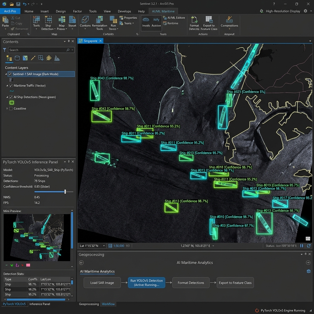
AI ship detection add-in
ArcGIS Pro Add-In

ArcGIS Pro Add-In for AI Ship Detection

Maritime object detection across SAR and optical imagery using a custom-trained PyTorch YOLOv5 model wrapped in ArcPy.

ArcGIS Pro SDKC# / .NET 8PyTorchYOLOv5SAR
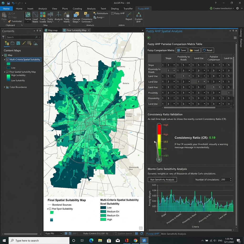
AHP FAHP analyzer add-in
ArcGIS Pro Add-In

AHP / FAHP Spatial Analyzer Add-in

Spatial MCDA with real-time Consistency Ratio validation, ArcPy raster overlay and Monte Carlo sensitivity analysis.

C#.NET 8ArcPyMonte Carlo
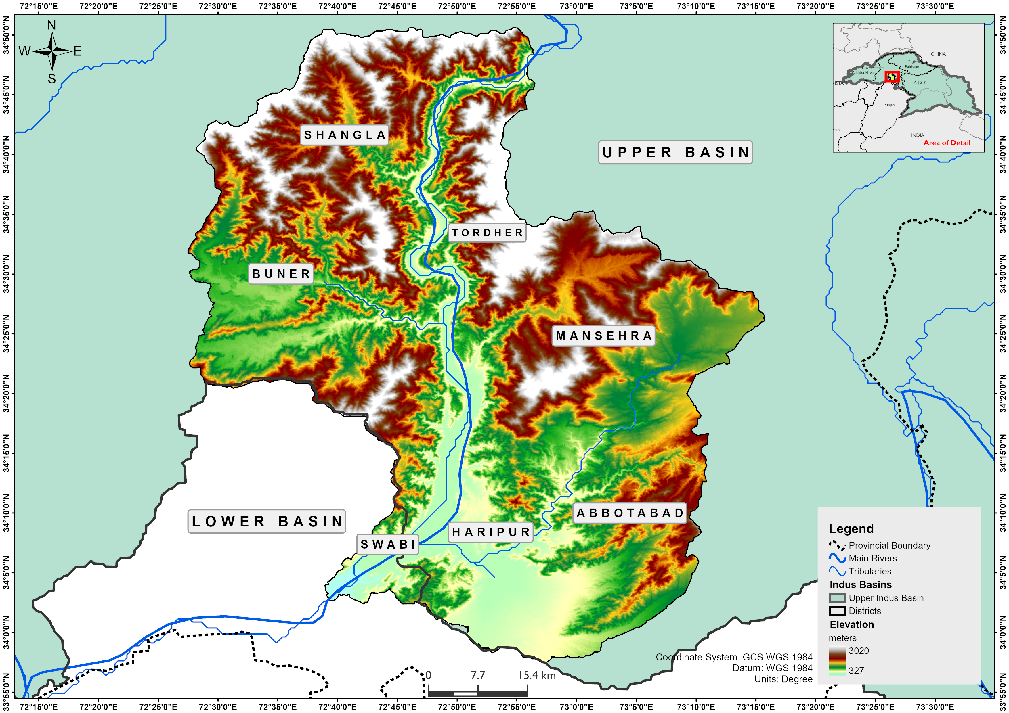
Tarbela study area
Remote Sensing

RUSLE Soil Erosion & Tarbela Reservoir Model

30-year climate-induced erosion and sedimentation modelling. Published research revealing a 65% capacity reduction.

RUSLEPythonLandsatSpringer
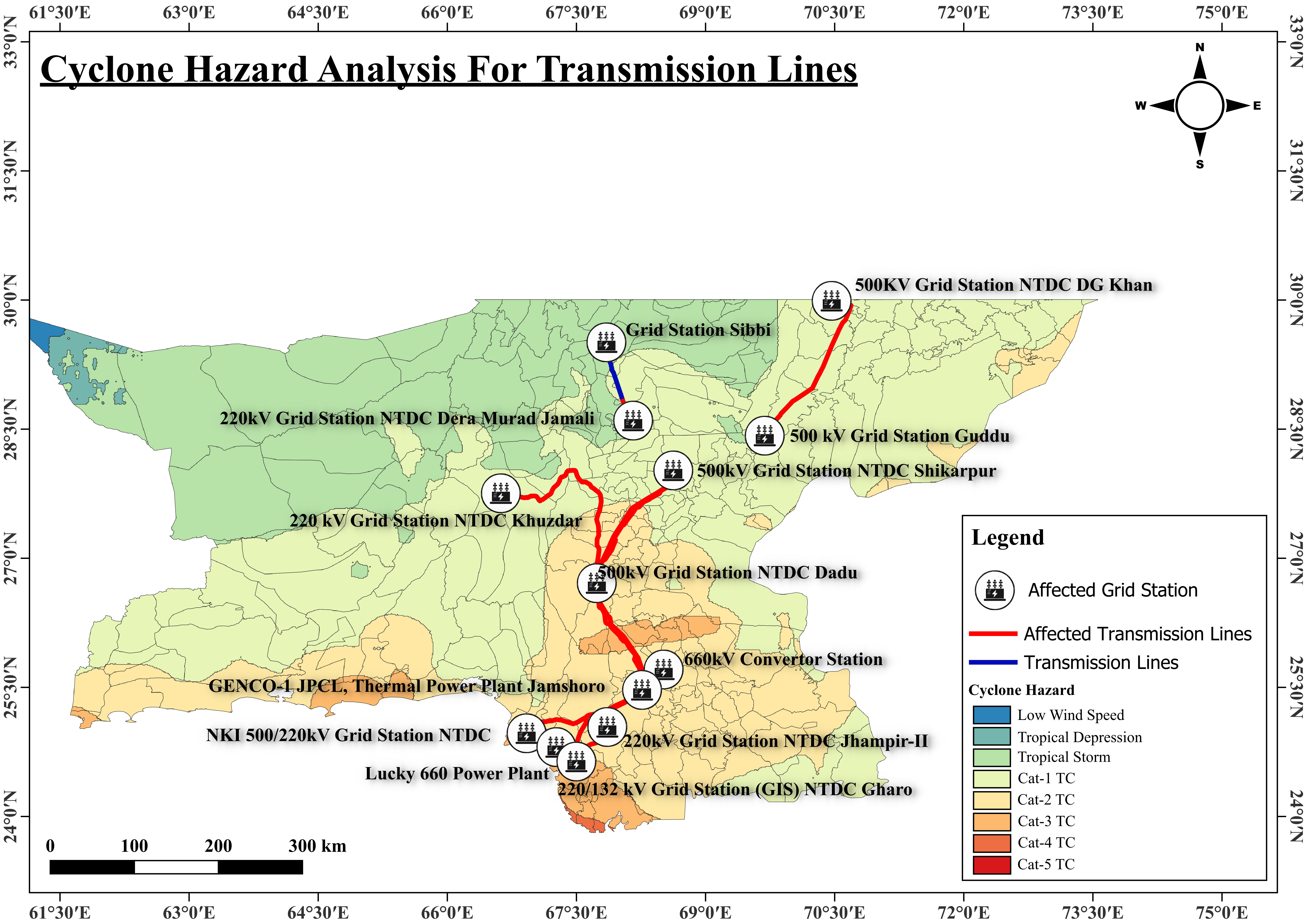
NGCP infrastructure risk map
Disaster Risk

Digitization of NGCP Infrastructure Data

Energy infrastructure digitization and multi-hazard risk analysis for cyclones and floods.

Disaster RiskSpatial AnalysisInfrastructure
Chakwal salinity map
Spectral Indices

Salt-Affected Soil Spectral Mapping (Chakwal)

Soil salinity mapping with NDSI, NDVI, VSSI and SI1–SI4 from Landsat 8/9 and Sentinel-2.

Sentinel-2Landsat 8/9Spectral Indices
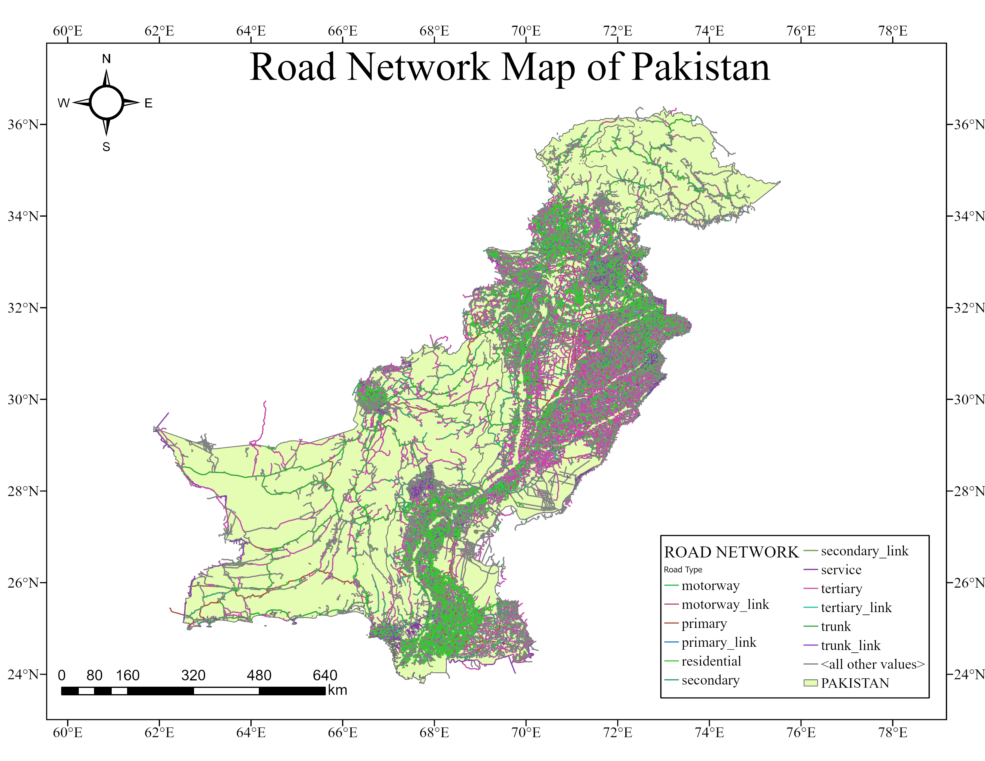
Pakistan NSDI road network
NSDI

Pakistan NSDI Road Network Digitization

A refined national road dataset resolving fragmentation, topology errors and misaligned geometry.

PostGISNSDITopologyQGIS
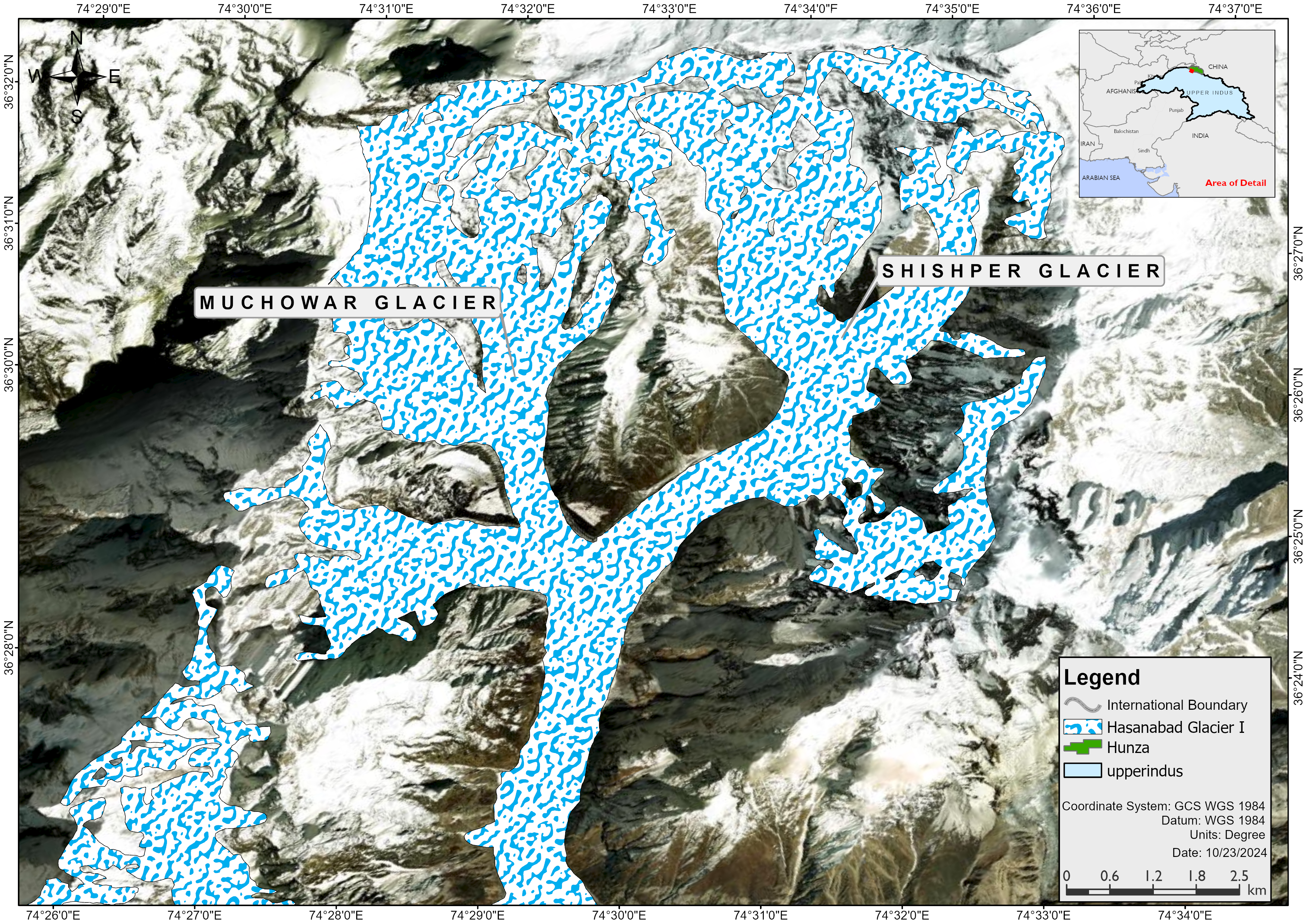
Shishper glacier study area
Disaster Assessment

GLOF Disaster Management: Shishper Glacier

Multi-sensor analysis (Landsat, Sentinel-2, ALOS PALSAR) of the 2022 Shishper glacial outburst flood.

ALOS PALSARThermal IRGLOF
Desktop App

Shapefile to KML Converter

Standalone Python GUI converting zipped shapefiles to reprojected KML, packaged with PyInstaller.

TkinterPyProjSimpleKMLPyInstaller
MCDA / GEE

Rainwater Harvesting Zonation (KPK)

Google Earth Engine and QGIS with FAHP to identify optimal rainwater harvesting zones in Khyber Pakhtunkhwa.

Earth EngineFAHPQGIS

04 — Published research

Peer-reviewed in Springer Nature.

International Journal of Environmental Research · 2026

Developing a RUSLE-Based Tool for Analyzing Climate Induced Soil Erosion and Reservoir Sedimentation in the Tarbela Region

Muhammad Arif Goheer, Sher Shah Hassan, Muhammad Taimoor Ashfaq Malik, Syeda Rosheen Raza Kazmi, Syed Zee Ali Shan

A Python GIS tool modelling 30 years of soil loss and storage depletion in Tarbela Reservoir, quantifying a 65% capacity reduction from sediment inflow.

Read on Springer

05 — Instruments

The stack on board.

Web GIS

React · MapLibre · Mapbox GL · OpenLayers · Leaflet · d3.js · GeoServer · TiTiler · FastAPI · Streamlit · GeoLibre · GeoLens

Programming & SDKs

Python · C# / .NET 8 · ArcGIS Pro SDK · ArcPy · GDAL · JavaScript · Node.js · Django

GeoAI & Data

PyTorch (YOLOv5) · LangChain · Ollama · PostgreSQL / PostGIS · MySQL · Spatial MCDA / FAHP · ETL

GIS & RS Software

ArcGIS Pro · QGIS · Google Earth Engine · ERDAS Imagine · ENVI · eCognition · OSGeo4W · OSGeoLive · AutoCAD Civil 3D

Ops

Linux · Docker · PyInstaller

07 — Uplink

Establish
uplink.

Building web GIS at HeraldX. Open to collaborations, consulting and research partnerships in Web GIS, GeoAI and remote sensing.

Copied to clipboard!